|
|
|
|
|
||||||||||
|
|
|
||||||||||||
Cycling routes - Cyrcle around Zamagurie
|
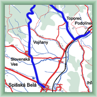
Length: 60 km Dificulty: difficult Bikes: The route starts in Spišská Belá and continues through the Slovenská Ves to Magurské saddle (difficult rise). Than the rooute goes slowly down into the valley of river Dunajec and through Spišské Hanušovce and Matiašovce to Spišská Stará Ves. There we turn to Červený Kláštor, direction Velký Lipník. In Haligovice we turn to the right. The second heavy rise is to Toporecké saddle. Then we go down through Topirec and on state road No. 77 to Podolínec. |
|
 Click to show full-size map
| ||||||||||||||||||||||||||||||||||||||||||||||||||||||||||||
| ||||||||||||||||||||||||||||||||||||||||||||||||||||||||||||||
 |
Czech mountains |  |

